Sunday, 19 May 2013

Cornwall Holiday - The Lizard Walk

After a dry but cold night, we were up enjoying coffee outside the tent in the morning sun before getting ready for the short drive to Kynance Cove.  There, the National Trust car park attendant welcomed us to "the most beautiful cove in all of Cornwall", and I don't think he was far wrong.

It was a beautiful day and a fantastic walk, and the best way to write this one up is with pictures. To see  the large versions, just click on the photo, and scroll through the selection below.

We started our walk at Kynance Cove

Our first views of Kynance Cove
Absolutely gorgeous, we couldn't stop taking photographs
Across the cove is a little cafe.  As we approached the tide was coming in.  The short way to get to the tea shop is to cross the cove before the tide gets too high, by walking underneath the bulk of rock you can see on the right hand side
Once we got across, we could investigate and admire the rocks and the waves.  Wonderful
We walked/climbed up the other side onto Tor Balk, and were able to look down on The Bellows.  How blue is that water?  Gorgeous
We easily spent an hour wandering around the cove, up this way and that, wearing the camera batteries out.  A really lovely place to be and I recommend it to everybody. But we were here to walk, so we set off East across Lizard Downs.
Lizard Downs are a National Nature Reserve.  The flowers everywhere we glorious, so pretty in the sun. 
We made our way towards Cadgwith, passing St Wynwallow Church on the way.  I wandered around the cemetery as Peter took more photographs.  I came across the grave of a man who died in 1909, aged 21.  Laid with him was his daughter, Phillipa, who died in 1918, aged 9.  And finally his wife, who died sometime in the 1960's, aged 81.  A poignant story carved in three matter of fact lines.
St Wynwallow Church near Cadgwith
From there we made our way to the coastline and followed the Coastal Path from just South of Cadgwith back to Kynance Cove.  A magical walk where stunning sights and views appeared around every bend.
We hadn't even started down the Coastal Path when we got to The Devil's Frying Pan

Looking South along the coastline.  This cove is Polgwidden.  In the top left corner of the picture you can just see a the lifeboat station. 
Polbarrow
Bass Point Lookout Station ahead.  It's manned by volunteers 24hrs a day
We walked to the end of Pen Olver  where we took masses of photo's.  This is one of my favourites
Looking back across Housel Bay
The Lion's Den.   A collapsed sea cave.  Deep and very scary to be on the edge of. 
Lizard Point ahead.  Well, the touristy bit of it anyway.  This is the most southernly point of England.  Of course, we stopped to enjoy a cup of tea and the views. 
Looking back to Lizard Point (the touristy bit).  You can just see an old disused pier, centre left, which used to be used by the RNLI.  It was from here that the greatest sea rescue in the history of the RNLI took place - You can read the amazing  story by clicking the link>> The SS Suevic,
And the coastline continues to delight us.
Approaching Kynance Cove and the end of our walk.  Lion Rock ahead, with Gull Rock and The Bishop behind.
Looking back across Pentreath Beach.  
Lion Rock from behind.  I'm just about to reach the viewpoint where the first picture of this blog entry was taken.
Kynance Cove, the tide is going out to reveal the sands.  Wonderful.
And then it was very sadly back to the car.  We'd had such a wonderful day, the deluge of splendid, amazing and beautiful views overwhelming the eyes and mind, I didn't want it to end.  

We walked nearly 9 miles and took all day about it.  Absolutely fantastic. 

Saturday, 18 May 2013

Cornwall Holiday - Kennegy Cove

Peter loves Cornwall.  I'd never been until he took me to a camp site near St Just in August 2009.  That week we packed two fantastic weeks worth of holiday into five days.  And it was during those five days that the background picture (the turquoise blue water and rocky shoreline) to this blog was taken.  How could we not go back?

So we both arranged our time off, loaded up the car, and set off on the seven hour drive that would take us to the wonderful little camp site Kennegy Cove.  With views of the sea, and being minutes away from the South West Coastal path this site was perfect for us.  The shower/loo block was clean and new having just been refurbished. There was no-one else camping, so we were the only tent and we could pitch and spread out whichever way we wanted.  And the biggest bonus was that the weather was sunny and dry most of the time we were there.  Just wonderful. 

We arrived about 6 pm Saturday night, and after setting up the tent, the first thing we wanted was food.  We found a chinese all you can eat buffet style place, which was cheap n cheerful enough and more importantly, meant we didn't take long filling our stomachs, because we wanted to get back to the camp site then go on for a walk down to the beach at Kennegy Sands.  As we put our boots on, I felt like a kid going out to play.  
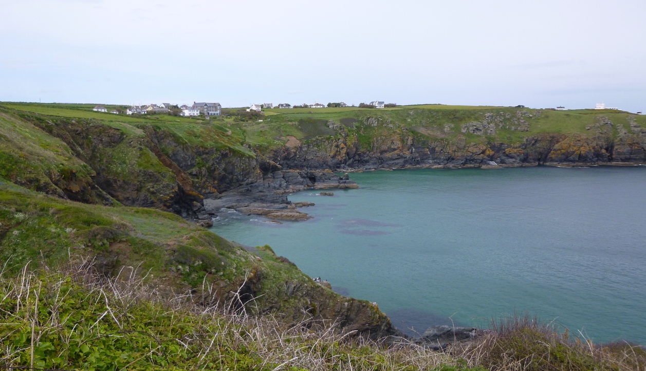
As we approached Keneggy Cliff, we could see The Enys (far left) and the tiny Kings Cove just between the Enys and the buildings.  We thought the buildings were abandoned, but no, a light came on.  Later we found out that collectively those buildings make up a rather grand house and grounds. But we never found out what it was called.   
We made our way to the cliff just above the beach, but sadly, the path down to it was closed, from what we could see, the cliff had fallen away, and despite our hopeful efforts, there wasn't a way down.  
Looking West over from Kennegy Cliff over Kennegy Sands.  There looks to be a cave.  Now how can we get there?

Looking East over Kennegy Sands, Hoe Point just ahead and Trewavas Head in the distance.  The beach looks so inviting. 
It was beginning to get dark, but "just five more minutes" found us making our way West along the Coastal Path to a point where we could make our way down to the rocky shore near Kings Cove .  We could see that when the tide was out, we would be able to make our way across the rocks to Kenneggy Sand, and explore the beach properly.  But not tonight.  We had to get back to the campsite before it got really dark.  We saved this place for another day .

Wednesday, 8 May 2013

Blencathra via Hall's Fell Ridge


One of our aims this year was to get me up the summit of Blencathra.  Peter had worked out a route to get there without going along Sharp Edge, (cos there is no way I am going along that!), and this weekend was the weekend to do it.
Now he could have picked Scales Fell, or Doddick Fell, but he chose Hall's Fell and Hall's Fell Ridge.  He says he's not been up that way before, he didn't know  anything about the ridge and he didn't notice how tight the contour lines were on the map.  Me?  As soon as I saw the route,  I immediately spotted how tight the contour lines were, which led to immediate research and immediate images of how steep the sides of that ridge are.  
As it happens,  I got some help from Sharkey's Dream, and looking at a few pictures on his blog post convinced me it would be a good route, not scary at all.

Hah!

We decided Bank Holiday Monday would be the day, cos the met office (who are of course absolutely always right), said it would be absolutely stunningly gorgeous from about 1 o'clock onwards, so we didn't hurry and arrived at Threlkeld about midday, turning into the tiny village and heading for the car park.

The car park is not very big and you pay using the honesty box.  It lies just at the base of Gategill Fell, and is the perfect starting point for our walk.  Our late start paid off, as we approached, Blencathra had his head in the clouds.  Mist and grey swirled above us over the higher ground, but we knew it would disappear as the afternoon wore on.


As we reached the base of Hall's Fell, we watched in admiration as three farmers and their dogs worked together to bring a flock of sheep down the steep banks, across the river and into a pen.  The farmers probably thought we were slightly nuts as we watched, in awe at how the dogs worked, happy and excited.  We both have a real respect for such a well developed working partnership.  This scene never ceases to amaze, and we will always stand and watch in wonder.


So now we were at the start of the ascent.  I am very slow up hills, the steeper, the slower.  In front of us was one very steep hill.  But it was fine.  I took my time,  and Peter took his photographs.   We paused to enjoy the views as they began to open out.  We spent time trying to work out the names of the fells in the panorama before us, and gradually we made our way up over the bulk of the fell towards the ridge.  All the time, the clouds above us were clearing, and it wasn't long before there was little overhead except blue, blue sky and bright warm sun.  A cool breeze made it perfect.   

 I was sort of looking forward to seeing the ridge and making our way across.  Peter really didn't know what was coming and was pleased with the sight as we rounded the side of one burly knoll of rock and Hall's Fell Ridge suddenly appeared  before us.


 Generally Hall's Fell Ridge is a bit exposed and scrambly. 


Peter found it easy and exhilarating.  I found it fun, but occasionally scary. In fact, one small section was too exposed and scary for me to tackle,  and we had to backtrack and make our way along the side.  But then, making our way along the side and up was also scary, cos the side is steep.  But you avoid thinking about it, and keep making your way up and along.


With a little encouragement from Peter, I managed the rest of the ridge with just one more little wobble. 


The  final approach to the summit was quite steep, but not too difficult, and then, all of a sudden, we were there.  

The views are stunning, especially on bright sunny day.  It's amazing how steep and rough the sides are on the south and east of the mountain, compared to the gentler grassy slopes of the north and west.  I wanted to see Sharp Edge, so we walked over to a point above Scales Tarn to have a look.  Sharp Edge doesn't look like it deserves its reputation from where we were.


 We spent a while up there, on the top of the world.  Glorious in the sunshine, we could see everywhere laid out before us.  We sat for a time, soaking it all up.  

Sadly we couldn't stay forever, so we turned to make our way back along Blease Fell.  Such an easy route down in comparison to the way we'd gone up, although it was a long one.  To our delight, the paragliders came out to entertain us as we walked.

They rose on thermals from valley floor, gently wheeling around and around.  They soared past and above us, absolutely silent, rising on the warm air in front and behind.  It seemed they were everywhere.


 What a fantastic experience it must be to fly that way.  And how lovely for us to see them.


And then, it wasn't too long before we were back at the car, and then onto the beer garden of the Horse and Farrier Inn to finish the day with a long cool drink.    I thoroughly enjoyed that one.  Now I know what Hall's Fell Ridge is like, I would be very happy to do it again.  I might even go over that scary bit next time.

Just over 5 miles, and 2500ft of up. An excellent afternoon.