Tuesday 6 August 2013

Kinder Downfall


Today's walk was up to edge of the legendary Kinder Scout.  I've heard so much about Kinder Scout, Kinder Downfall and of course, The Kinder Trespass., it was time I saw it for myself, and Peter worked out a route of just over 7 miles taking us up onto the edge and along to Kinder Downfall.  Peaks and groughs could be saved for another day.

So we parked up below the memorial plaque in the first picture and set off.  The route wasn't too difficult, we made our way through a field of cows ( I always have to mention them, cos they make me nervous). Once again we made it to the other side of the field unharmed. We walked along the edge of the wood which backs onto Kinder Reservoir until we got to it's most easterly tip.

What I didn't know was that Peter had planned the route with the assumption that a path that ran out on the map wouldn't really run out or come to a dead end.  That would be silly, people don't just walk so far and then turn back.  He was confident it would continue on the ground.

Look up to Kinder Edge
We did sort of find a path, that sort of went in the right direction.  But it also sort of kept fading in and out.
In the end, we gave up trying to follow it and basically went for Peter's favourite way of getting to the top - straight up!

The heather was putting on an awesome purple show all along the banks 
We ended up making our way through thick heather, rough ground and bog up the steep slopes of the bank. Hard work!   But finally we met up with the path coming from The Three Knolls.  I was so relieved.  Walking is much easier when you have a path, and your feet don't drop into unseen dips and holes.

The Path from The Three Knolls

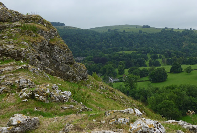
Rock formations in the Peak District are always fascinating.  

Not much falling at Kinder Downfall today 
Walking on, we clambered over the waterfall of Red Brook, (we could have followed the path that went round the top, but it was much more fun this way), and enjoyed the views of Kinder Reservoir and beyond. We reached Kinder Downfall where we planned to have a pie stop, but our plans were thwarted by three devious ladies who were after our pies.

They were already at Kinder Downfall when we got there, mingling with the walkers.  We hardly noticed them as we admired the views and then took loads of photo's.  But they'd been eyeing us up from the start. We settled down on a convenient rock with a good view, and rummaged a steak pie out of the rucksack. I'd just got it out of the wrapper when I realised that one of the three had sneaked up behind me and was just about to nab the pie from my hand.  I pulled it back quickly, shouting at her, but she hardly stepped back.  She just stared at the pie, waiting for me to give it to her. Peter had to stand up and chase her off, shouting and growling.  Who would believe it?  A sheep tried to steal my pie?

We sat down and tried again, but it was no good.  There were three ewes circling us, bouncing from one rock to another and getting closer all the time. Peter got up and chased them off again, but the biggest of them (I've named her Ma Baker), just wasn't afraid.  She hardly got out of Peter's way, and just kept eyeing up our food.......... Menacingly!

We quickly gave up trying to eat in peace and moved away from the waterfall. I've never come across such fearless sheep before. Other walkers must have happily given them sandwiches and titbits in the past. Us two greedy beggars who wouldn't share were obviously something very new to them.

Beware Ma Baker and her gang of thieves.  Well practiced in snack snatching, they have no fear of people. 

Looking over Kinder Scout from the other side of the river to the sheep 
We did enjoy a cup of tea in peace further along though.

We came down the bank via William Clough, (which at least had a path), until we reached Kinder Reservoir and then the road back to the car park.


Just over 7 miles and 1900ft of up.  The up bit was challenging, (as per the map below),  the edge bit lovely, the rest bit wasn't very restful, and you had to keep an eye on where you put your feet on the down bit.  All in all a good day.   And what about Ma Baker?  I wonder if she and her cohorts are still up there chasing down buns and sandwiches?

Sadly, although we planned to continue our mini tour of England and Wales by going on to Wales after this walk, we were thwarted again.  Disappointingly, our campervan broke down and we had to return home.  Wales will have to wait.

Monday 5 August 2013

A Day in Castleton


Peveril Castle
Day two of our little mini tour was forecast to be a very wet and miserable day.  So leaving the walking boots at home and armed with an umbrella, we took a wander around the little village of Castleton and it's sights.

Using our English Heritage membership, we first chose to visit Peveril Castle.  The blurb says "A climb to the castle at the top of the hill to enjoy the breathtaking views over the Hope Valley is a highlight of a family day out in Castleton."  And they're not wrong.

View from one of the windows of Peveril Castle Keep

Another view


The Keep of Peveril Castle

Looking over the castle walls to Cave Dale.  Doesn't that look like a wonderful place to walk
Another fine view. 

It's not a very big castle and soon enough it was time to visit our next planned attraction, a Blue John Stone mine.

Derbyshire Blue John is only found under Treak Cliff Hill near Castleton. It's a stone of many colours and patterns and can be carved and into all sorts of household ornamental items. It became extremely popular in the 19th century for those who could afford it, see link for more info: http://www.bluejohnstone.co.uk/

There are a couple of Blue John mines open to visitors.  We chose The Treak Cliff Cavern. We had to wait for the next scheduled tour, but once inside we were well entertained by the guide, who was also one of the few miners permitted to continue the delicate process of easing the precious stone out from the surrounding rock. We did enjoy our tour, although, in comparison to other mines we visited, there wasn't a lot too this one.

But I love stalagmites and stalactites and all the underground formations. Wonderful.


So that was day two.  We have another walk in the Peak District planned for day three. 

Sunday 4 August 2013

Dovedale

Dove Dale and the Stepping Stones across the River Dove.  A favourite area for picnics and enjoying the scenery. 
At the beginning of August, we set out on a mini tour of some of our favourite places in the UK.  Unfortunately, we didn't get as far as we would have liked, but that's another story.  We started our road trip with a visit to the Peak District, and this little 6 mile walk.

Starting at the Dove Dale car park shortly after lunch, we followed the river Dove to Milldale, enjoying the river, the plants and our surroundings.
I know this as Marjoram, but the Americans might call it Oregano. 
The steep sides of Dove Dale are pitted with caves and fabulous water and weather sculpted rock formations.  We had to climb a short, but very steep and slippery path to get a closer view of Reynards Cave.  It's not really a cave, more of a glorious arch.

Reynard's Cave.  It was so tempting to make our way through to the caves beyond, but we resisted.  We spend so long investigating spots like this, we end up running out of time for the rest of the walk.  


A bit further along the river Ilam Rock draws the eye.


More caves.  This is one of the Dove Holes.  And yes, we spent time to climb up and investigate.  They are very wet and slippery inside, which hampered my exploration a little.  The safest way to come down and get out was on my bottom. 
Monkeyflowers.  An American invader


Viator's Bridge at Milldale.  It had started to rain, so we took shelter under a tree to take photo's.  
At Milldale we took some time out for a cup of tea and a bit of flapjack, and to shelter from the rain, which had become almost torrential.  We met a couple who'd completed 20 miles so far and were just of to complete the final 6.  Hmmmmmm.  I don't think Peter and I are quite up to that level of fitness.

Rain stopped and tea all gone, we set of the the second half of our walk up the hill west of the river and turning to make our way back to the car park.  On the way we met loads of walkers coming the other way on a charity walk, and like them fought to open a gate that wouldn't open.
There was a stile alongside, and I think it had to be the most difficult stile I've ever come across.  You ended up straddled over the top of the wall trying to get your legs and feet over from one step to another.  Quite ridiculous really.  Another walker going the opposite way had obviously seen us clambering over without and grace or decorum and decided to go through the gate.  Guess what?  Just like us he spent a couple of minutes trying to get the gate open before making the undignified clamber over the stile.   I think the farmer must have been chuckling away for hours when he built/rebuilt that stile.

We carried on towards Bunster Hill, following a path that works around the hill about half way up the slope, which is pretty steep.  There was a hairy patch when we came across an area where the path the had landslipped down the slope, but views across Ilam and beyond.

A view from  Bunster Hill


And from there we made our way through fields of cows, calfs and respective bulls on our way back to the car park.  As always, I felt nervous, but they all behaved with impeccable manners and completely ignored us.  Phew!

My only other comment regarding cows is "Cor Blimey!  Have you heard the racket calves make when they're suckling?  Noisy beggars!"
We were quite amazed by it.


A lovely little afternoons walk, and more days in the Peak District to come.  Wonderful.