Wednesday, 5 October 2011

Ingleborough


Clapham Beck
I’ve been looking forward to this, because it’s been ages since Peter and I have been out walking.  The weather has been brilliant all week, but the forecast wasn’t good, (I told Peter it said it would rain).  Nevertheless, we were still hoping for a warm dry day up a hill.
As we were driving to Clapham we hit a heavy downpour.  Not good!  I said we could walk next weekend.  Peter said it would blow over.  It stopped. So we parked outside Clapham hall, donned our boots and rucksacks and started off.  
It was a good start.  We followed the top path to Clapdale Farm (rather than pay the 60p each to walk along the privately owned Clapdale Drive lower down).  From there we dropped down the hill and walked along the track to Ingleborough Cave. 
Clapham Beck Head


Just past it is the head of Clapham Beck in the form of a spring that pours forth from a cave.  Nice. 

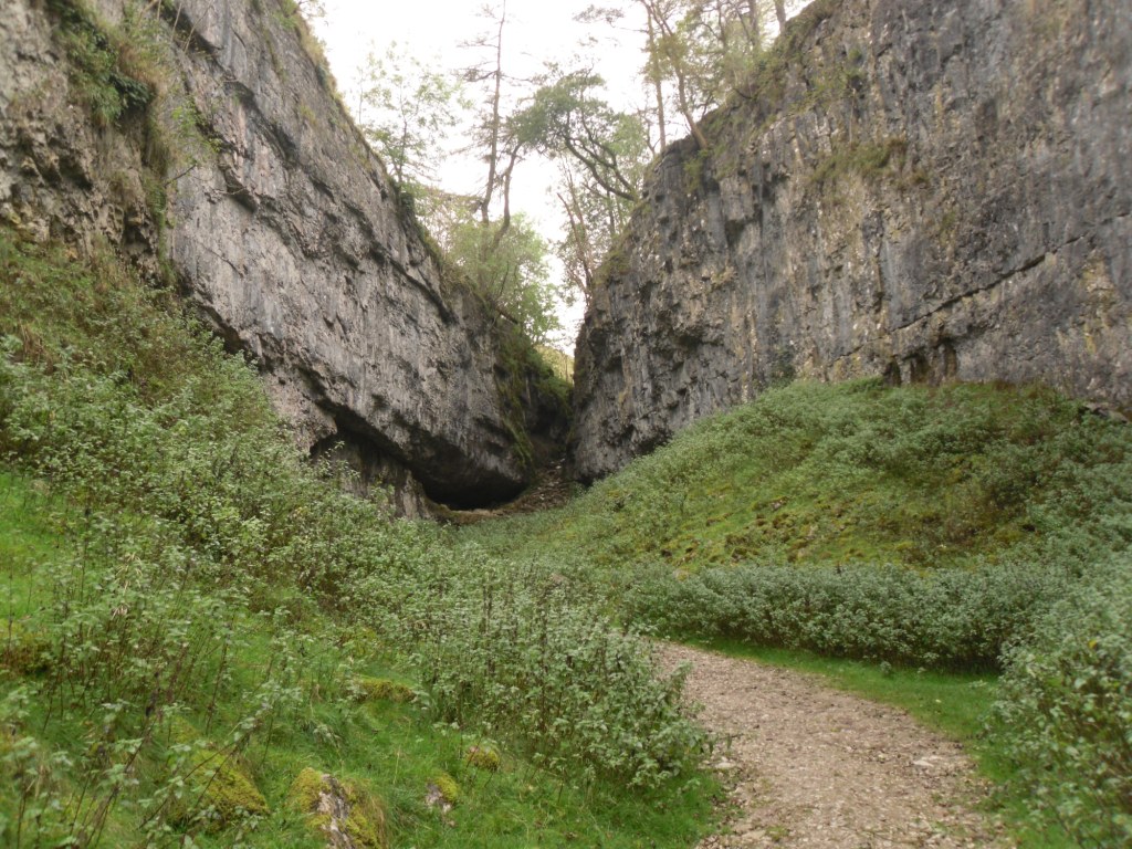
Trow Gill
Approaching Trow Gill


We continued along the track to Trow Gill.  On the photo’s, it looks more than it is.  It’s a pleasant place with cliff sides, a cave and the Gill itself which is easy to walk up.

The Ingleboroughs.  Little Ingleborough on the left

Up through Trow Gill and on through a deep sided gulley to an open expanse of moorland and view of The Ingleboroughs.  Sadly, it started to rain at this point, that persistent type that isn’t a downpour, but gets you wet anyway.


Gaping Gill
We walked on to have a look at Gaping Gill, a very large hole in the ground into which falls Fell Beck.  As you can tell from the link, there are two occasions where common or garden non pot-holing folk can see inside.  I think I might do that next year.
 From our vantage point we couldn’t really see down the hole, despite our best efforts, so we took the photographs we could and returned to our planned walk by crossing Fell Beck.
“Watch out!  It’s slippy!” yelled Peter as he nearly went over.  “OK” I said, and moved to cross at a different point.  Uh oh!
The Slippery Fell Beck
It was very slippery, and I landed very firmly on my bottom.  Peter came to rescue me.  He landed very firmly on his bottom too.  As we both sat there, bruised and confused in the beck, we burst out laughing.  But we realised that the longer we stayed, the wetter we’d get, so we very quickly got out!
So now I’m wet through to my knickers and all the way down the back of my legs.  Water is trickling into my boots.  Peter has a wet behind and it’s raining.  Do we go on?  Do we go home? We were midway between the car and Ingleborough. Based on the principle that if we kept moving, we’d keep warm and probably steam dry, we carried on.
Ingleborough Summit Cairn


The rain continued and got heavier.  As we started up the slope of little Ingleborough we discussed going back, but onward and upward, up to the top of Little Ingleborough we went. The path then levels out for a bit before you start climbing to the top of Ingleborough Peak itself.  The cloud base was sinking and the rain kept coming, but eventually we got there.  We walked across the very flat top to the weather shelter where I managed to get a photo of the summit cairn. We couldn’t see far but we did make out some of the surrounding hills as we paused for a well earned steak slice.
Now to go back.  Due to the now soaking wet nature of our attire we made the decision to curtail our original route, and leggit back as fast as possible. We belted off the top, down the side, and made short work of the route back to Gaping Gill across the moor.  And still it rained.  We walked past Fell Beck and continued back the way we’d come through Trow Gill.  Carefully this time, because it was wet and slippery.  On past Ingleborough Cave and then we chose the private track along Clapdale Drive, because there was no-one to collect the toll and it was quicker.  The rain continued.


The private path comes out at Clapham next to a very pretty waterfall, which I think is manmade.  We’ve been here before and I have sunny day pictures.  We didn’t stop to admire this time though, it was still raining.
Finally we got back to the car.  Totally, totally, soaking wet but satisfied with our effort. Driving home past Ingleborough, we noticed the cloud base had sunk to cover the summit and we felt pleased we’d got up there earlier.
When we got home, Richmond was dry.  Now, three days later, we know that we must have found the wettest, rainiest patch in the whole of England to walk.  If we’d gone anywhere else, we’d have stayed dry. I suppose it’s all down to experience.  (And I did tell him it would rain).


The route we planned.
The route we took

Saturday, 1 October 2011

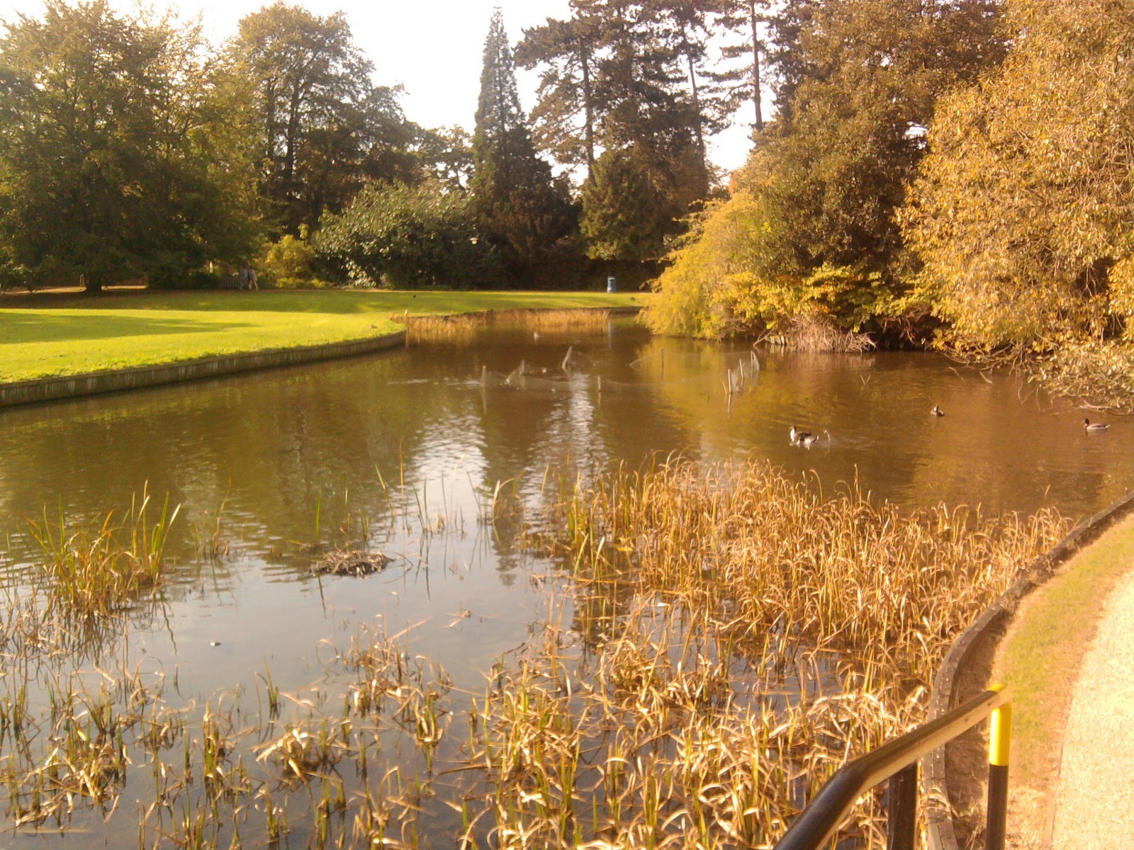
Little Pond, Black Swans.

Alright, it's not a cruise, and it's not a walk, (unless you count the 30 yards across the grass from the Uni Buildings), but it was such a lovely day and this is "Getting about a bit".  Today I got to York University so that my  daughter could attend the Open Day.  Whilst I was there, I was totally taken in by a family of black swans.  At least I think they were, it seemed like two adults and two youngsters.

Weird birds, they don't seem to be able to lift their heads and their necks seem to be arched all the time, they are smaller than white swans and they make a very sweet sort of hooting horn noise.  The ones at the Uni pond, along with all the water birds there, were very tame and came up to me looking for food.  I thought they were lovely.


Sunday, 25 September 2011

A little wander in Wensleydale - Ayesgarth, West Burton and the River Ure


Ayesgarth High Falls

I discovered the Walking Forum  a little while ago, and through it, ended up making arrangements with Cheviot Stroller, AKA Rambling Nana (see blog links), to meet up for a walk.  We decided on Ayesgarth, and I worked out a route of about 8½ miles.


 We both arrived in the NT carpark, smiled hello at each other, and set out to view the delights of Ayesgarth and beyond.  The route can be seen on the map at the end.  
Cauldron Falls

After a quick look at the Upper Falls, the first half of the walk took us through the fields to West Burton, where we saw the village waterfall, also known as the Cauldron Falls.  

Then we climbed gently along grassy tracks to a point where we were overlooking the dale.  Not very high, but high enough to get some delightful t views.  Along the route we spotted a squirrel dash away from us along the wall.  The fact that it chose not to run up a tree made us look again, and we quickly realised that it was a stoat. Cool!
Look back on the Morepeth track

Eventually, we turned left to make the gentle descent towards Swinithwaite.  Enjoying the views, we were also amused by the antics of several rams in the field next to us.  I swear it looked like only one of them was brave enough to investigate whatever it was in the hedge that caught his eye.  His five or so “mates” were all bunched up about 10ft behind him.  We could almost hear them egging him on as the whole group crept towards the hedge.   Curiosity could have killed the ram? 
Looking across to Nossil Bank


Just below Lower Falls

Through Swinithwaite, across a few more fields and then we spent the second half of the walk alongside the River Ure heading back to our starting point.  The river itself is fascinating, with the loads of waterfalls, and rocky stretches.  With the variety of birds and flowers around, there is always something that catches your eye. 


Looking up at Lower Falls


I personally prefer being on the south side of the Ure as you approach Ayesgarth.  I think you get to see so much more of the river and all its nuances.  


Lower Falls again


But we did cross over and take a look at lower and middle falls using the NT walk on the north side.  These touristy viewing points allow you good views of the falls, especially if you go to the very end and climb down to get an excellent view of the lower falls. 


Middle Falls


A bonus for me was that I got to see the grey heron that spends a lot of time at middle falls.  I even took a blurry picture.
Another lovely day in very pleasant and quietly tuneful company.  Now……….. Where next?