Saturday 26 October 2013

Bolton Priory, a waterfall and more heather than planned.

As usual, the weather forecast was one of the determining factors when we were trying to work out where to walk, and as it happened, Bolton Priory was in the dry zone. Since I've always wanted to have a closer look at the Priory ever since I saw it during a walk along The Strid a couple of years ago it was easy to use it as a starting point for a walk.

To visit Bolton Priory is free, but it costs £4 to park in the Priory car park.  Canny eh?  But not a problem, I realised we'd probably got our money's worth when I saw the deep the muddy grooves our campervan had made in the grass as we parked.  [Sneaky chuckle].
Paid and parked we started on our planned 8 mile walk by crossing the road over to the Bolton Priory site. Then we stopped walking and had a wander around the Priory ruins.


I found it quite fascinating that half the priory was a ruin, and the other half was being used as a church.  We would have wandered into the church for a look, but there was a wedding on.   I looked, but I'm pretty sure they weren't gonna let us in.

Having sated our appetite for the old masonry and roofless buildings, we had another go at starting our walk.  First we crossed the River Wharfe, using the conveniently provided bridge.
Look carefully at this picture.  There's something missing, only it isn't.  This caused real confusion later on.
On the east side of the river, we followed the Dales Way north(ish), enjoying the the autumn colours and the occasional burst of sunshine.

At Posforth Bridge, we turned off to follow a track into The Valley of Desolation.   All the trees got blown down here in a terrible storm in 1826, making the little valley very desolate, (that's how it got its name see), 'cept it's not very desolate really, because it's been a long time since 1826 and all the trees have grown back.

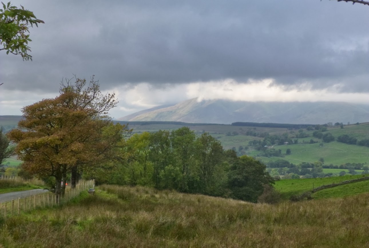
I really liked this magnificent and slighly quirky oak tree
I really liked this fungus in the next picture. Then I found out it's called "Many Zoned Polypore". What kind of name is that!   It sounds like an architects design for a shopping centre, or a plastic carrier bag with pockets.  This fungus needs a better name. Trouble is, I can't think of any. Suggestions in the comments section please.
There's an unnamed waterfall on Sheepshaw Beck.  We'd heard it last time we walked this way, and, just to prove that sometimes we actually make wise decisions, we decided to divert and go take a look.  


What a stunning little fall, I'll swear I saw a fish in it.  The fish looked like it was trying to jump the falls, in the way I've seen the salmon do it on TV.  But then it could have been the fish was being washed over the falls, and was facing the wrong way.    I kept looking, but I didn't see another fish.


We sat and had our lunch here, in a glade in the wood overlooking the waterfall. The sun came out and kept us company for half an hour too.  How nice.  


After the valley of desolation, we were supposed to walk through the managed forest and then take a right turn to Agill House and follow the track to Broadshaw.  But we missed the turning, and we didn't know we'd missed the turning until we took the wrong one and ended up on something that looked like a path, but turned out to be very definitely not a path. Gizmo (the GPS), couldn't help cos he'd been given a different route
Our difficult but very interesting detour following a wall around the moor. Fortunately the scenery was wonderful, so it sort of made up for trying to find our way through boggy marsh and untrod heather

Peter was getting cross, because he could see where he wanted to be - i.e. that path in the distance but there was a massive great wall in the way and no path on the other side of it.  We kept following the wall until eventually we found a track, which led to a gate, which led to another track and finally.... Voila! We were back on course at Broadshawe. 
Black Pasture
It didn't take us long to walk from Broadshawe back to the Wharfe at Stead Dike.  We crossed the bridge there, so that we could walk on the west side, downriver and back to the Priory.  We saw a sign for the Stepping Stones and wondered where they were, as we'd not seen them on the way up.  Then there was another Stepping Stones sign, but for the life of us, we couldn't work out where they were.  We decided they must be further downriver, something to bear in mind next time we came this way. 
Back at the Priory, the church was open, and no one else was getting married so we popped in to have a look.

It was odd inside, because there wasn't a big stained glass over the altar end.  The wall separating the ruined part of the Priory from this church wouldn't have been there before, and the Nave would have continued on into the Choir and the Chancel.


And then it was back to the van where we changed out of our boots, felt ever so slightly guilty about the dents in the ground and set off for home.  We'd walked 7 1/2 miles and 1300 ft of up, so not a difficult walk.  (Unless you take a detour through the heather).

Here's a map of the intended route:


Back at the Ranch...............

Later on we were looking at the photo's.  Take a look at this one again:

Now we know where the Stepping Stones are! 


Saturday 12 October 2013

Aira Force and Ullswater.

Peter worked out a circular walk from Aira Force, past Gowbarrow Park, Little Mell Fell and Little Meldrum, through the woods, past a bit more of Gowbarrow Park and back to Aira Force.  

As usual, (cos we don't like getting out of bed in the mornings), we didn't arrive at the car park until gone midday. The weather wasn't brilliant, the sky was overcast and a bit moody,  but the weatherman said it would be dry all day, and we believed him. 

Aira Force is a bit touristy, loads of people were out wandering about the paths near the car park.  There is plenty to see, with Aira Force the main focus of attention, but as you walk on,  Aira Beck is full of little rushes and gushes and little waterfalls.  We wandered this way and that, admiring and photographing, and took ages to get to the gate where we left the National Trust owned land and start on the rest of the walk. (Click on the pictures to get a larger version).

Our first crossing of Aira Beck.  I couldn't resist the gorgeous colours of the autumn bracken

Aira Force.  There were a lot of people out for the walk, including japanese tourists, complete with cameras.  I had to wait a while as they all took turns in posing in front of the falls before I could take this picture.  

This pretty little bridge was built and dedicated to an ambassador of the first world war.

This tree deserves a special mention.  Look at the bottom.  It grows out of the rock and then up at right angles. Amazing!

High Force............ but not THE High Force
So eventually, we got out into the fields are started to make our way north, with Gowbarrow Park on our right. The photo below is looking south, back along our route, so Gowbarrow is on the left.
Looking back, I think that's Place Fell, on the other side of Ullswater. 
We walked on around the craggy rocks of Gowbarrow, following the pleasant grassy path towards Ulcat Row, where we would join the road.  It was just before the road section that we sat and tucked into a late lunch amongst a field of sheep.  The sheep stared, and obviously thought we were a bit weird, but to be honest, we thought the guy that passed us was even weirder.......   (And there you go! Proof that we make snap judgements based on a person's appearance, and despite all advice to the contrary, still judge a book by it's cover.  It seems thousands of years of survival instincts can't be wiped away by a few hundred years of civilisation, or even several hours of management training.)

But back to lunch and our lunchtime views, too our left, Great Dodd and Clough Head, and to our right Great Mell Fell and Little Mell Fell.

Great Mell Fell. 
We stayed on a the road for a while
Mungrisdale and Blencathra
Until we finally came to a path on a right which would take us Little Meldrum and then Great Meldrum. It was only now that I started to see Ullswater properly.  I never realised how long it is.

It took me a while to work out, but the little white house is Leeming Cottage,  with Barton Fell and Loadpot Hill on the other side of Ullswater. .........   I've never heard of Loadpot hill before?  But that's what the OS Map says. 
With Ullswater on the left, the path gently arcs around Swinburn's Park into a managed forest.  All the time, more and more of Ullswater was appearing to me and I kept taking pictures.  Sadly though, I realised the views I was enjoying wouldn't be there forever, as you can see in the photo below, many trees have been planted, and it won't be long before the lake would be obscured.
Ullswater from above Swinburn's Park.  Hallin Fell, Sleet Fell and High Dodd (amongst others) on the other side. 

Ullswater from Collier Hagg

Ullswater again.  This time from Hind Crag.  I love the colours of the Bracken in this picture. 


A really nice afternoon's walk and we were back in time to watch a bit of Strictly.


Our route, just short of 8 miles with 1650ft of upping and downing.


Oh!  And we were right to believe the weatherman (this time).  It was dry all day.  

Saturday 5 October 2013

Up and Down in the Howgills

I would love to be a lady wot lunches and have all the free time I wanted.  But then, if I was, I wouldn't be lunching, I'd be out, all over the countryside getting sunburn, windburn, rain sodden (but not too much I hope), nettle stung and muddy. I'd try to be walking two or three times a week.  I might even spend so much time out in the countryside that I'd have to lunch more because I'd lost weight.

OK, so maybe that's a pipe dream, but I've still got my fingers crossed every weekend, hoping that the lottery is going to change my life.  Sadly, every Monday I set off for another week at work, but all the time I'm keeping an eye on the weather forecast and planning the next walk.

You could say that I only treasure these days because I can't go whenever I want and that if it wasn't for work, I wouldn't appreciate the walks so much.   I'd say "Cobblers!",  I still want to be a lady wot lunches.

Having said all that, I wasn't so sure about today.  I've been eyeing up the walk we had planned with a little nervousness.  We'd tried it before, and I had really struggled to get up the first hill and in the end we'd had to cut the walk short and return to the car:  A short walk in the Howgills, .  Even though I knew that I was much better now than then, I was still worried about this one.

But I needn't have been.  The first climb is quite steep, and then it eases off and the rest of the walk, whilst hard work in parts, was thoroughly enjoyable.  Here are the pictures: (Click on the images to get the larger version).

The steepest part of the work, up alongside Settlebeck Gill

(Nearly) wild horses in the distance

Looking back  after the steep climb up.  Crook and Soolbank on the left, Winder on the right.

The highest looking lump is Bram Rigg Top at 674m, behind it is real highest lump, The Calf at 676m. The rolling fells here remind me of knuckles and fingers.  It was at this point as we came out of the shelter of Arant Haw, we were hit by the wind.  It kept us "cool" all along the heights. 

The bank over there is Bram Rigg, our route takes us along the right, (off the photo), to just the other side of the fell. We then turn left onto the ridge, and follow it down to cross Bram Rigg Beck that you can at the bottom. 

This is my favourite photo's of the day.  I love the windswept grass, and the way the fells roll and fold into each other.  

Coming around Bram Rigg Top onto the ridge that we're going to descend.  You can see Morecombe Bay in the distance.

We were lucky, the moody looking clouds waited until we'd left the heights before burying the tops under clag.

Looking back up Bram Rigg. 

A view from the bottom. 

Near the end of our walk, looking across to the Shap Fells.
As you can see, we spent the day under moody clouds that threatened to drench us most of the way.  But it didn't rain, and most of the time it was very warm.  The route is up and down and bit, which tires the legs, (it took three days for my thighs, and five days for my calves to recover).  We walked 8.4 miles with 2570ft of up.